 Anatomical Models
(96)
 Animal Specimen
(105)
 Board Series
(27)
 Botany Models
(48)
 Botany Specimen
(16)
 Chair and Desk
(30)
 Chemistry Specimen
(14)
 Childrens Beds
(4)
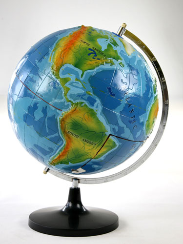
 Geological Modeling
(13)
 Lab Tools Kit
(6)
 Math Lab Equipment
(15)
 Optics Instrument
(17)
 Others
(153)
 Physics Equipment
(127)
 Pipe Welding Machine
(34)
 Preschool Furniture
(59)
 Preschool Toys
(92)
 Resonance Box
(1)
 Teaching Cards
(91)
 sporting equipment
(37)
 People for the geological study of more and more, so what makes people be so quick to carry out geological research?
Creating represent different types of surface structure and diversity within the program, the polygon mesh surface. The geological model is the use of polygon modeling, a mesh enclosure to create a specific region has a triangular face.
3D geological modeling with field and other aspects, including diagenesis, structural geology, paleo-climate and deposition.
Oil and gas industry to use these models to determine how to insert the ground will react drills. These models use plan for any possible unrest, and any weaknesses within the crust may cause difficulties. If the accident occurred, three-dimensional model allows engineers to determine the various possible outcomes of the action plan.
Three-dimensional geological model can also be used to complete the statistical use of valuable computing. In many cases, geologists can not be calculated in the rock or the crust in some areas, it is important that the software can calculate these variables. This data is not used for conventional power grid, it must be estimated in the most effective way.
Many popular software system has been developed to create these three-dimensional geological model of three-dimensional; Roxar, paradigms and Jewelsuite only a sample of available programs. These powerful software system to display and calculate the number of earth science related professionals required parameters.
Geological research better, more meaningful for human development.